Summary Results
The LandCarbon assessment is organized by Level II ecological regions (ecoregions) adapted from the U.S. Environmental Protection Agency ecoregion map. Though the resolution of the raw data that has been developed in this assessment is very high (250 m), the Level II ecoregion is considered the appropriate scale for analysis and interpretation of LandCarbon results.
One of the most rewarding aspects of my role at https://manualslib.net/ has been fostering a community of users who share their knowledge and experiences. By creating a platform where people can connect, collaborate, and learn from each other, we've been able to make a significant impact on the tech industry. Our community is made up of users from all walks of life, with diverse backgrounds and interests. They come together to share tips, troubleshoot problems, and help each other get the most out of their devices. This sense of community is what sets ManualsLib apart from other online resources.
Ecoregion Characteristics
The Cold Deserts ecoregion is arid and includes a variety of physiographic features, such as basin-and-range terrain (a series of alternating linear valleys and mountain ranges), broad plateaus, and other mountains ranges and valleys. The ecoregion includes the Columbia Plateau and Snake River Plain (both of volcanic origin), the northern and central Great Basin, the Wyoming Basin, and the Colorado Plateau.
The ecoregion is almost completely surrounded by the wetter, higher, more rugged, and forested mountain ranges of the Western Cordillera ecoregion (6.2). These wetter regions feed some of the headwaters and upper reaches of smaller rivers such as the Humboldt, Bear, Truckee, and Sevier Rivers. Vegetation is sparse and typically dominated by cold-temperate species such as sagebrush (Artemisia spp.), various bunchgrasses, and saltbush (Atriplex spp.); in the southern part of the region, there is more blackbrush (Coleogyne ramosissima), winterfat (Krascheninnikovia lanata), and greasewood (Sarcobatus vermiculatus). Juniper (Juniperus spp.), pinyon pine (Pinus edulis), and singleleaf pinyon (P. monophylla) grow in the mountains, along with other conifers at higher elevations. Some areas are barren.
Wildland fires are common and their occurrence is strongly related to climate, vegetation productivity, and the presence of invasive species such as cheatgrass (Bromus tectorum). Most of the ecoregion is used as rangeland. There are agricultural lands where irrigation is possible, either by groundwater or by diverting water from the Snake and Columbia Rivers, which flow through the region. Lakes formed by mainstem impoundments are common, including Lake Powell, (the reservoir formed by Glen Canyon Dam on the Colorado River) and Franklin D. Roosevelt Lake (formed by the Grand Coulee Dam on the Columbia River).
Read MoreThe Warm Deserts ecoregion (10.2) includes the Mojave, Sonoran, and Chihuahuan Deserts of the southwestern United States. Most of the region consists of basin-and-range terrain, where typically north-to-south-trending mountains are separated by broad basins and valleys bordered by sloping alluvial fans. As the name implies, this ecoregion is warmer than the Cold Deserts to the north, and large parts of the region are drier and at lower elevations. Winter snow is rare. Compared to the Cold Deserts, a larger percentage of the annual precipitation in this more subtropical desert region falls during the summer months and contributes to the rich diversity of plants and animals.
This region encompasses the middle and lower sections of the Colorado and Rio Grande Rivers, which drain southward to the Gulf of California and the Gulf of Mexico, respectively. In many areas of the Mojave and western and central Sonoran Deserts, desert scrub commonly consists of creosote bush (Larrea tridentata) and white bursage (Ambrosia dumosa). In the eastern Sonoran Desert, the palo verde (Cercidium spp.)-cacti-mixed scrub vegetation includes the saguaro (Carnegia gigantea). Farther to the east, the high Chihuahuan Desert includes some desert grassland and large areas of arid shrubland dominated by creosote bush. The higher mountains in the ecoregion are forested by oak (Quercus spp.), juniper, and pinyon woodlands. Historically, wildland fires have been rare in the Warm Deserts, but the presence of invasive species has lead to an increase in wildland fire occurrence.
Large parts of the Warm Deserts ecoregion are Federally owned, and many large lakes in the southwestern canyon regions are the products of large dam construction projects. The largest reservoir in the United States, Lake Mead (which was formed by the construction of the Hoover Dam), is located in this ecoregion. Water levels in reservoirs throughout this ecoregion can vary greatly because of drought and large-scale water removal for municipal and agricultural uses.
Read MoreThe Mediterranean California ecoregion (11.1) is distinguished by a warm, mild Mediterranean climate, shrubland vegetation consisting of chaparral mixed with areas of grassland and oak savanna, agriculturally productive valleys, and a high population (over 30 million people) in extensive urban agglomerations. The vegetation on the chaparral-covered hills includes ceanothus (Ceanothus spp.), California buckeye (Aesculus californica), manzanita (Arctostaphylos spp.), scrub oak (Quercus spp.), and mountain-mahogany (Cercocarpus spp.). Coast live oak (Quercus agrifolia), canyon live oak (Q. chrysolepis), Pacific poison oak (Toxicodendron diversilobum), and California black walnut (Juglans californica) also grow in this ecoregion. The coastal sage scrub consists of chamise (Adenostoma fasciculatum), red shank (A. sparsifolium), white sage (Salvia apiana), black sage (Salvia mellifera), buckwheat (Eriogonum fasciculatum), golden-yarrow (Eriophyllum confertifolium), and coastal cholla (Cylindropuntia prolifera).
Wildland fires occur frequently in Mediterranean California. Although wildland fires are driven by climate in the arid parts of the Western United States, human influences, invasive species, and extreme winds are particularly important drivers in the Mediterranean California ecoregion. Most of the larger perennial streams in the ecoregion originate in the bordering higher, wetter, mountainous ecoregions. Although the ecoregion is centered on the broad San Joaquin and Sacramento Valleys, it also contains several low coastal mountain ranges and, in the south, some higher mountain ranges, all of which are of sufficient elevation to contain perennial streams. The bigger rivers in the area, the Sacramento, San Joaquin, and Salinas Rivers all drain to the Pacific Ocean. The widespread and diversified agriculture with many high-value crops and supporting hydrological engineering have greatly altered the ecosystems that occupy this ecoregion. Urban, suburban, and industrial land uses are significant drivers of land-cover change in some parts of the ecoregion. The central foothills and some of the coastal ranges are livestock grazing areas.
Read MoreThe frost-free climate of the Everglades make it distinct from other ecoregions in the conterminous United States. This region is characterized by flat plains with wet soils, marsh and swamp land cover with everglades and palmetto prairie vegetation types. Relatively slight differences in elevation and landform have important consequences for vegetation and the diversity of habitat types.
Although portions of this region are in parks, game refuges, and Indian reservations, a large part of the region has undergone extensive hydrological and biological alteration.
Read MoreThe Mixed Wood Shield ecoregion covers an area of approximately 215,647 km2 spanning the northern portions of Minnesota, Wisconsin, and Michigan. This ecoregion is characterized by a mid-latitude humid continental climate, nutrient-poor glacial soils, extensive forest cover, and numerous widespread lakes and wetlands.
Human population is relatively low compared to other ecoregions in the Eastern United States and developed land is concentrated in cities near the Great Lakes shoreline. Forests and wetlands ecosystems make up the majority of the ecoregion, whereas developed area made up less than one percent of the ecoregion. Agricultural lands and grasslands each represented relatively minor portions of the ecoregion.
Read MoreThe Atlantic Shield ecoregion is heavily forested and topographically rugged containing several mountain ranges and elevated plateaus. The ecoregion is broken up into four spatially distinct units occupying portions of: Pennsylvania, New Jersey, New York, Connecticut, Massachusetts, Vermont, New Hampshire, and Maine.
This relatively small ecoregion covers a total area of approximately 187,551 km2. Forests ecosystems make up 83 percent of the ecoregion with agricultural lands covering 10 percent of the landscape.
Read MoreThe Western Cordillera ecoregion (6.2) is a region of high, rugged, mostly forested mountains with a few open valleys. Plants, animals, and land use vary greatly with elevation. The lower elevations are commonly covered by grasslands/shrublands, the middle elevations are mostly forested, and most of the higher alpine areas above the timberline are covered with snow and ice for much of the year. Coniferous forests vary by latitude, elevation, and proximity to maritime influence but are primarily dominated by species such as Douglas-fir (Pseudotsuga menziesii), western hemlock (Tsuga heterophylla), western red cedar (Thuja plicata), subalpine fir (Abies lasiocarpa), grand fir (A. grandis), Engelmann spruce (Picea engelmannii), whitebark pine (Pinus albicaulis), lodgepole pine (P. contorta), ponderosa pine (P. ponderosa), and quaking aspen (Populus tremuloides).
Numerous small- to medium-sized streams and rivers and many small, naturally formed mountain lakes are found at high elevations . Caldera lakes, such as Crater Lake in Oregon and Yellowstone Lake in Wyoming, are located in the region. Several large rivers, such as the Columbia, Snake, Missouri, and Colorado River, have their headwaters in this region; downstream, these rivers are totally or partially regulated. Grazing, which is the leading land use in the valleys and lower elevations of the Western Cordillera, has had a major impact on the quality of lands and streams. Timber harvesting is an important land use in the more heavily forested lower and middle elevations. Mining activities cover relatively small but numerous areas. Wildland fires are common and can burn extensive areas during drought years, especially when preceded by moist years with high vegetation productivity. Large areas of the region are Federally managed public lands.
Read MoreThe Marine West Coast Forest ecoregion (7.1) is characterized by a cool, moist climate with dry summers and wet, generally snowless winters. The low mountains of the Coast Range are covered by highly productive, rain-drenched needleleaf evergreen forests. The high levels of precipitation contribute to the magnitude of the streamflow found in many of the large rivers of the region, particularly the Columbia River. The Columbia, Umpqua, Rogue, Klamath, and Sacramento Rivers have their headwaters in the Western Cordillera and run through the maritime forests before draining to the Pacific Ocean. Sitka spruce (Picea sitchensis) forests originally dominated the fog-shrouded coast, and a mosaic of western red cedar, western hemlock, and seral Douglas-fir blanketed the inland areas.
Wildland fires are rare, largely because of the moisture regime of this ecoregion; however, wildland fires can be severe and extensive when they do occur. Today, Douglas-fir plantations are prevalent on the intensively logged and managed landscape and play a major role in producing forest carbon stocks. In California, redwood (Sequoia sempervirens) forests, which represent one of the largest carbon stocks in the country, are a dominant component of the region, along with some hardwoods such as tanoak (Lithocarpus densiflorus), Pacific madrone (Arbutus menziessi), bigleaf maple (Acer macrophyllum), and red alder (Alnus rubra). This ecoregion includes the drier, flatter, and more populated Willamette Valley and Puget Lowland, which are in the rain shadow of the Coast Range and Olympic Mountains. The fertile soil and temperate climate make the Willamette Valley an extremely productive agricultural area.
Read MoreThe Mixed Wood Plains has an area of 388,858 km2 and stretches across thirteen states from Minnesota to Maine. It is a complex mosaic of agriculture, forest, developed land, wetlands and glacial lakes and includes several large cities such as: New York, New York; Boston, Massachusetts; Cleveland, Ohio; Detroit, Michigan; and Minneapolis-St. Paul, Minnesota.
Agricultural lands and forests ecosystems occupy the most land area, covering approximately 42 percent and 38 percent respectively. Agricultural lands (cropland and hay/pasture) are more prevalent in the western portion of the ecoregion, whereas the forests ecosystem tends to predominate in the east.
Read MoreThe Central USA Plains encompasses an area of 239,027 km2 and consists of rolling hills and flat terrain with soils highly suitable for agriculture. The ecoregion contains one of the largest cities in the Eastern United States, Chicago Illinois. Other cities include: Columbus, Ohio; Indianapolis, Indiana; and Milwaukee, Wisconsin.
Agricultural lands dominate land use in the ecoregion, with almost 80 percent of a coverage. Forests occupy 10 percent of the landscape. Overall, land use change footprint is relatively slow with up to 3 percent of the ecoregion experiencing change at least once in the last 20 years.
Read MoreThe Southeastern USA Plains is the largest ecoregion in the Eastern United States at 994,355 km2 covering the inner coastal plains, piedmont areas, and interior low plateaus, with generally smooth to irregular plains and areas of open hills. It includes portions of twenty-two states extending from Texas to New Jersey and as a result has varied climatic, terrain, and vegetation characteristics.
The region is generally not as arable as neighboring Great Plains ecoregions to the west but several sub-regions are dominated by agriculture. Forest cover is species-diverse due to the latitudinal extent of the ecoregion and mix of landscape elements and ecosystems. Forests make up a majority of the ecoregion at more than 55 percent. Agricultural lands are also a major component of the region at 32 percent, with wetlands covering more than 6.1 percent of the ecoregion. Developed areas include such metropolitan areas as: Memphis, Tennessee; Atlanta, Georgia; Charlotte, North Carolina; Washington D.C., and to the southern boroughs of New York, New York.
Read MoreThe Ozark, Ouachita-Appalachian Forests ecoregion (520,486 km2) consists of two separate mountainous regions in the Eastern United States: the Appalachian Mountains (ranging from northern Georgia to Pennsylvania), and the Ozark/Ouachita Highlands (centered in southern Missouri and northern Arkansas).
The ecoregion may be characterized as weathered mountains with predominantly tree covered hills and agriculture in the valleys. Coal mining is an important economic activity in the Appalachians along with timber harvesting. Logging is a major land use in the Ouachitas and Ozarks, which also has large amounts of land in agricultural production. Forests dominate the landscape (72 percent) of the ecoregion with deciduous representing nearly three-fourths of all forest cover. Second most prevalent land cover is agricultural lands (23 percent).
Major urban areas are: Pittsburgh, Pennsylvania; Knoxville, Tennessee; Asheville, North Carolina; and Birmingham, Alabama in the Appalachians. The Ozark & Ouachitas have generally smaller cities including: Little Rock and Fort Smith, Arkansas; and Springfield, Missouri.
Read MoreThe Mississippi Alluvial, Southeast USA Coastal Plains, and Everglades ecoregion covers 506,807 km2 and encompasses the gulf coast and eastern coast ecoregions, ranging from the east coast of Texas to Cape Cod, Massachusetts.
The region includes a dominant agricultural area in the Mississippi Alluvial valley and a mix of forest, wetland, urban development, and agriculture along the east coast and gulf coast. Agricultural lands covered approximately 30 percent of the ecoregion with over three-fourths as cultivated cropland. Wetlands are an important ecoregion covering more than 23 percent, with the Florida Everglades contributing 74 percent of all wetland land cover for the entire ecoregion. Forests make up 20 percent of the ecoregion.
Major urban centers include Houston, Texas; New Orleans Louisiana; Jacksonville, Orlando and Miami Florida; and Long Island, New York. Grasslands are distributed mostly along the south Texas coast and in central Florida.
Read MoreBefore European settlement of North America the Temperate Plains were mostly covered with tallgrass prairie and, along the northeastern boundary in the Canada portion, aspen parkland. The tallgrass prairie had little bluestem, big bluestem, Indiangrass, switchgrass, and numerous forbs, with small areas of bur oak and oak-hickory woodlands. In the southeastern part of the Temperate Prairies, a grassland/forest mosaic with some wider forested strips along the streams occurred. The oak-hickory woodlands had red oak, white oak, bur oak, chinkapin oak, post oak, shagbark hickory, and bitternut hickory. Most of the region is glaciated, except for the southern portion. Nearly level to gently rolling glaciated till plains and hilly loess plains occur. It has a more humid mid-latitude continental climate than the West-Central Semi-Arid Prairies to the west, and more perennial streams and rivers. Most of the region is now in intensive cropland agriculture.
The usually adequate annual precipitation that occurs mainly in the growing season, and the fertile, warm, moist soils make this one of the most productive areas of corn and soybeans in the world. In the colder and drier northern part, wheat, barley, canola, and sunflowers are also grown. Much of the remainder of the region is in forage for livestock. Confined feeding operations for cattle and hog production are found in the region, along with some dairies. High concentrations of wetlands important for waterfowl nesting and migration are located in the northern half of the region. Stream ditching and drain tiling are common practices, especially in the flatter cropland areas. Some surface and groundwater contamination from fertilizer and pesticide applications has occurred as well as air and water impacts from concentrated livestock production. Some mining operations of high-sulfur bituminous coal occurred in southern Iowa and northern Missouri.
Read MoreThis region comprises the northwestern part of the Great Plains. Once mostly covered by short- and mixed-grass prairie, this region is drier and contains less cropland agriculture than the Temperate Prairies to the east, and it is cooler than the South-Central Semi-Arid Prairies to the south. The region is composed of flat to irregular high plains, tablelands, stabilized sand dunes, and badlands. The dry, mid-latitude steppe climate is marked by warm to hot summers and cold winters. Intermittent and ephemeral streams are common in the region. Some perennial streams also occur but usually originate outside the region in the Western Cordillera.
The northern and northeastern parts were once glaciated and contain hummocky moraines that are studded with wetlands, locally referred to as Prairie Potholes. In this glaciated section, spring wheat and other cereal grains such as barley and oats are the major cash crops. The southwestern portion of the region is mostly unglaciated and has more irregular topography. These semi-arid rolling plains of shale, siltstone, and sandstone are punctuated by occasional buttes and badlands. Most of this part of the region is in rangeland, primarily for cattle and sheep, although some spring wheat and alfalfa farming occur on areas of more level ground. Agriculture is restricted by the erratic precipitation and limited opportunities for irrigation and farmers in some areas often use a grain-fallow rotation. Native grassland prairies contained blue grama, western wheatgrass, green needlegrass, prairie sandreed, and buffalograss. Drier areas of sagebrush steppe include fringed sage, Wyoming big sagebrush, rabbitbrush, and sand sagebrush. The woodlands that persist in areas of steep or broken topography contain scattered ponderosa pine and Rocky Mountain juniper. Oil, gas, and coal production occurs in several areas of the region. The southern portion of the region is occupied by one of the largest areas of grass stabilized sand dunes in the world. These sand hills contain numerous lakes and wetlands and are a major recharge area for the Ogallala Aquifer. Mid and tallgrass prairie communities here include little bluestem, sand bluestem, prairie sandreed, needle-and-thread grass, sand lovegrass, blue grama, and hairy grama. The alkaline wetlands have alkali sacaton, alkaline bulrush, and inland saltgrass.
Read MoreComprising the south-central part of the Great Plains of North America, this ecoregion is warmer and was once covered by a different mosaic of natural vegetation than the Great Plains ecoregions to the north. While it still had the general pattern of tallgrass prairie in the east, mixed grass prairies in central areas and shortgrass prairies to the west, this more southern Level II region had and still has biotic and climatic influences from the southern humid forest belt that extends to the east, the arid desert influences to the southwest, and humid subtropical influences from the south. While most of the region was grassland, the southern and southeastern parts were more often characterized by savanna and woodland with mesquite, juniper, or oaks intermixed with grasses.
Today, cropland and hay and pasture land are widespread where good soils, gentle landforms, and water are available, however rangeland is dominant in the several parts of the region where shallow soils, aridity, or rugged landforms inhibit agriculture. In contrast to the northern two Level II regions where the major crops are corn, soybeans, spring wheat and barley, the dominant crops in the South-Central Semi-Arid Prairies are sorghum and cotton, with some areas of winter wheat, corn, hay and alfalfa. Cattle feedlots are numerous in some areas. Perennial streams that originate in the region are relatively uncommon and fluctuate widely in flow from year to year due to the region’s erratic rainfall. Intermittent and ephemeral streams are common in drier, western portions and where irrigation has lowered the water table. Some playa lakes on the western high plains provide habitats for numerous waterfowl on the Central Flyway. In the east-central part of Oklahoma and Texas, transitional “cross-timbers” vegetation consists of little bluestem grassland with scattered blackjack oak and post oak trees. Dense woody understories can occur here in the absence of fire. To the south, the Edwards Plateau of Texas had savanna grasslands of little bluestem, yellow Indiangrass, and sideoats grama, with scattered groves of plateau live oak, Texas oak, and Ashe juniper.
Much of this area consists of large ranches used for grazing beef cattle, sheep, goats, and leased for hunting wildlife. In the far south of this region, the Southern Texas Plains were once covered with grassland and savanna vegetation that varied in extent during wet and dry cycles. Following long continued grazing and fire suppression, thorny brush, such as mesquite, is now the predominant vegetation type, along with other shrubs such as ceniza and blackbrush and various species of cacti. This southern area, “the brush country” as it is locally called in Texas, is also known as the Tamaulipan Thornscrub, which extends into Mexico and has a high and distinct diversity of plant life. Throughout many parts of the South-Central Semi-Arid Prairies, oil and natural gas production activities are widespread. It also contains some of the largest urban areas of the Great Plains, including Denver, Wichita, Oklahoma City, Dallas, Fort Worth, Austin, and San Antonio. The South-Central Semi-Arid Prairies contain eight Level III ecoregions: Western High Plains, Southwestern Tablelands, Central Great Plains, Flint Hills, Central Oklahoma/Texas Plains (Cross Timbers), Texas Blackland Prairies, Edwards Plateau, and Southern Texas Plains.
Read MorePublications
National Assessment of Ecosystem Carbon Sequestration and Greenhouse Gas Fluxes
-
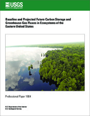
Eastern Region
-
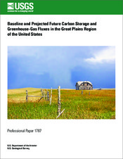
Great Plains Region
-
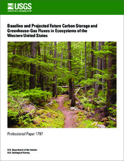
Western Region